
Indicator
Circular Business activities are revenue-generating activities, that contribute to the circular economy through one or more R-strategies. Core circular business activities generate at least 70% of the total business revenue. The port area is defined as the geographical territory managed by the Port Management Body (PMB).
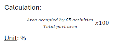
This indicator is relative, expressed as a share comparing the area occupied by core circular business activities to the total port area (this excludes the water body).
How to measure its value
Circular business activities can be identified by the relevant NACE-codes (Bel-first), linked to the R-strategies (cfr. indicator #1)
The occupied area can be obtained through the PMB (concession agreements), GIS-data or Google maps area measurement function. Total plot size can be used as area measurement.
Limitations
- The hierarchy of R-strategies and their impact are currently not considered, nor can they be directly linked to the plot size.
- Limitations for indicator 1 also apply to this indicator
- Periferal CE activities are not taken into account